

On our last day of three day weekend getaway, we decided to hit Rifle Falls on the way back from Meeker, CO.
We got out of the Green Cabin by 11AM, leaving a check on the counter for the manager (who we never even saw our entire stay). We ate leftover food from the Meeker Mexican Restaurant for breakfast, not wanting to take the time to stop along the way to Rifle Falls.
I started us off driving, and we made our way south to Rifle, and then took the turn-off to Rifle Falls prior to reaching the town. We were gearing ourselves up for another big hiking day, considering we did about 10 miles the day before.

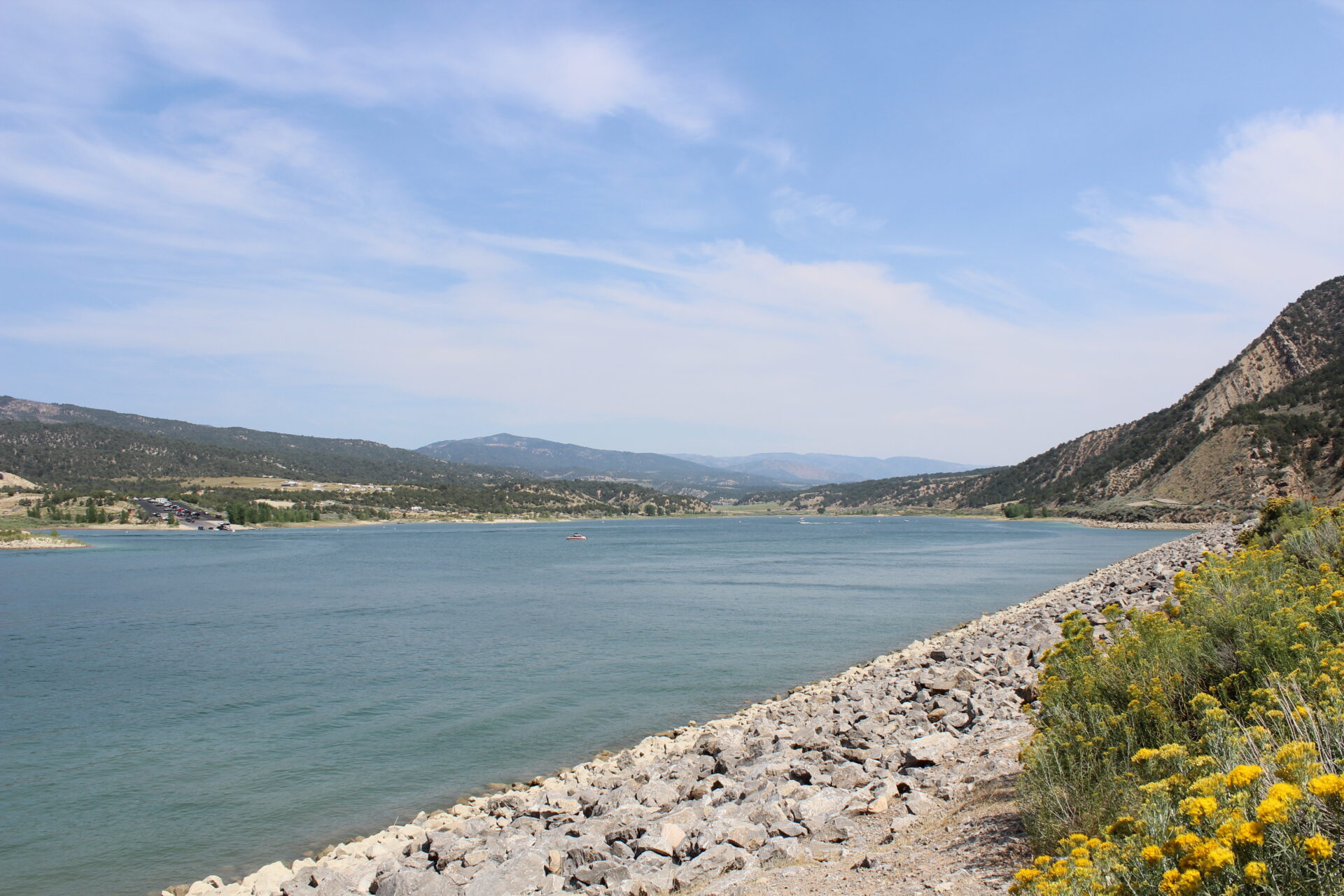
The drive there was gorgeous on a winding country road – we passed the golf course on the way too, which looked like another neat little mountain course to try playing (reminiscent of the Evergreen course). We also went by this awesome lake.
We reached the Rifle Falls State Park entrance in about an hour, only to discover that the parking lot was full. The Park Ranger was super nice and helpful though, and told us to drive North for about 1.5 miles and we would reach a secondary hiking trail that actually started at the top of Rifle Falls and included the caves. She said to look for the Riparian sign and the old chimney, and if we hit the fish hatchery, we’ve gone too far. This was a blessing disguise – we actually wanted a longer hike (the hike to Rifle Falls from the main entrance was only .25 miles), and we didn’t have to pay the parking fee.
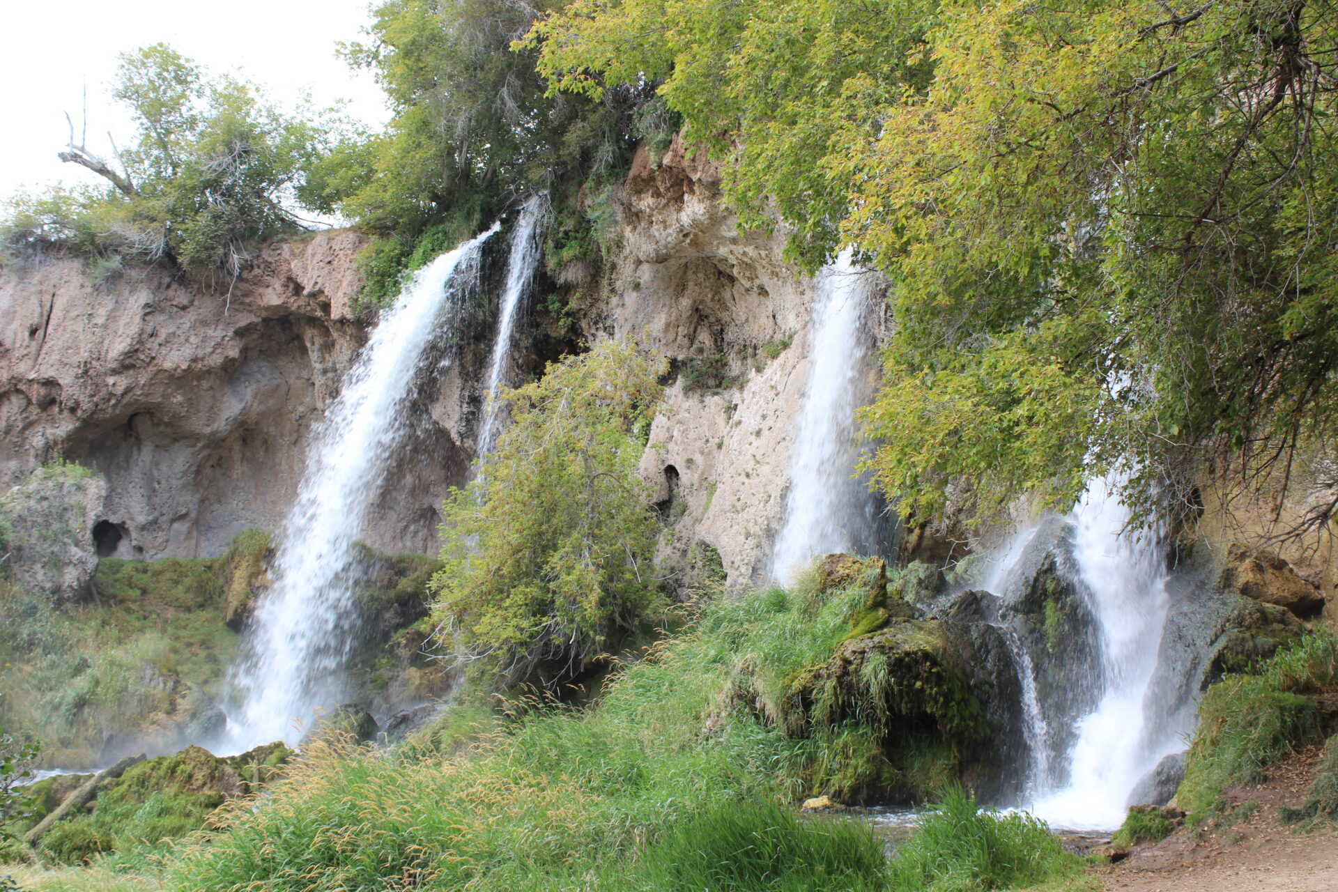
We began our hike thinking we knew what we were doing. We immediately found the start of the Rifle Falls and stopped to take a look.
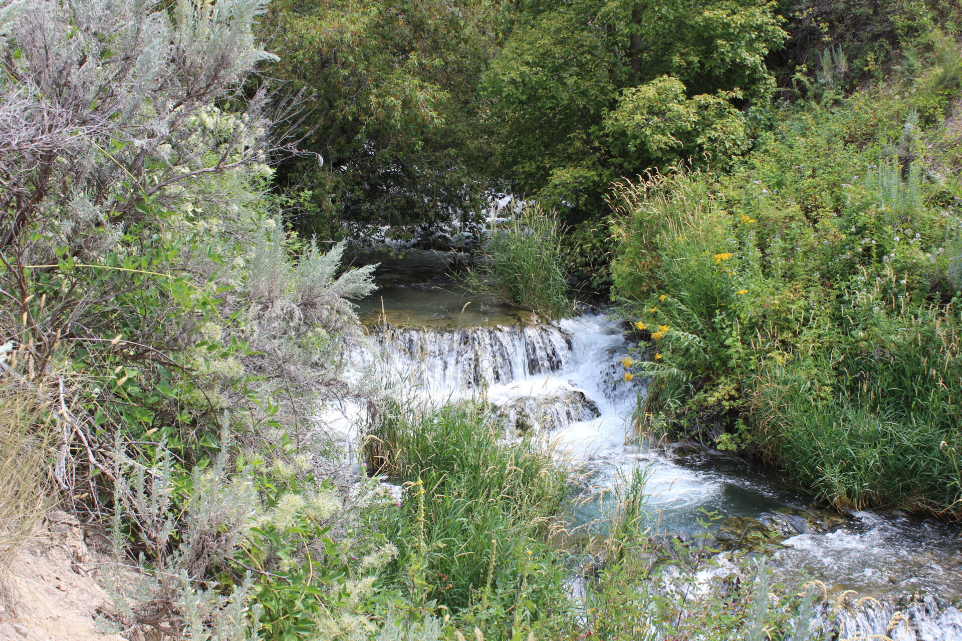
There were also some small rapids on the running stream that we explored.
The start of this hike, though, wasn’t on the map the Park Ranger gave us and after reaching several forks in the trail, and always sticking to the right near the creek and the road, we started second guessing our course. The trail markers were painfully unclear, just indicating that we were on a trail (left and right arrows) and not actually telling us where we were or what the name of the trail was.
The best part was a map that finally appeared around mile marker 1 that had a legend with a “You are here” dot, but the dot was missing from the map.
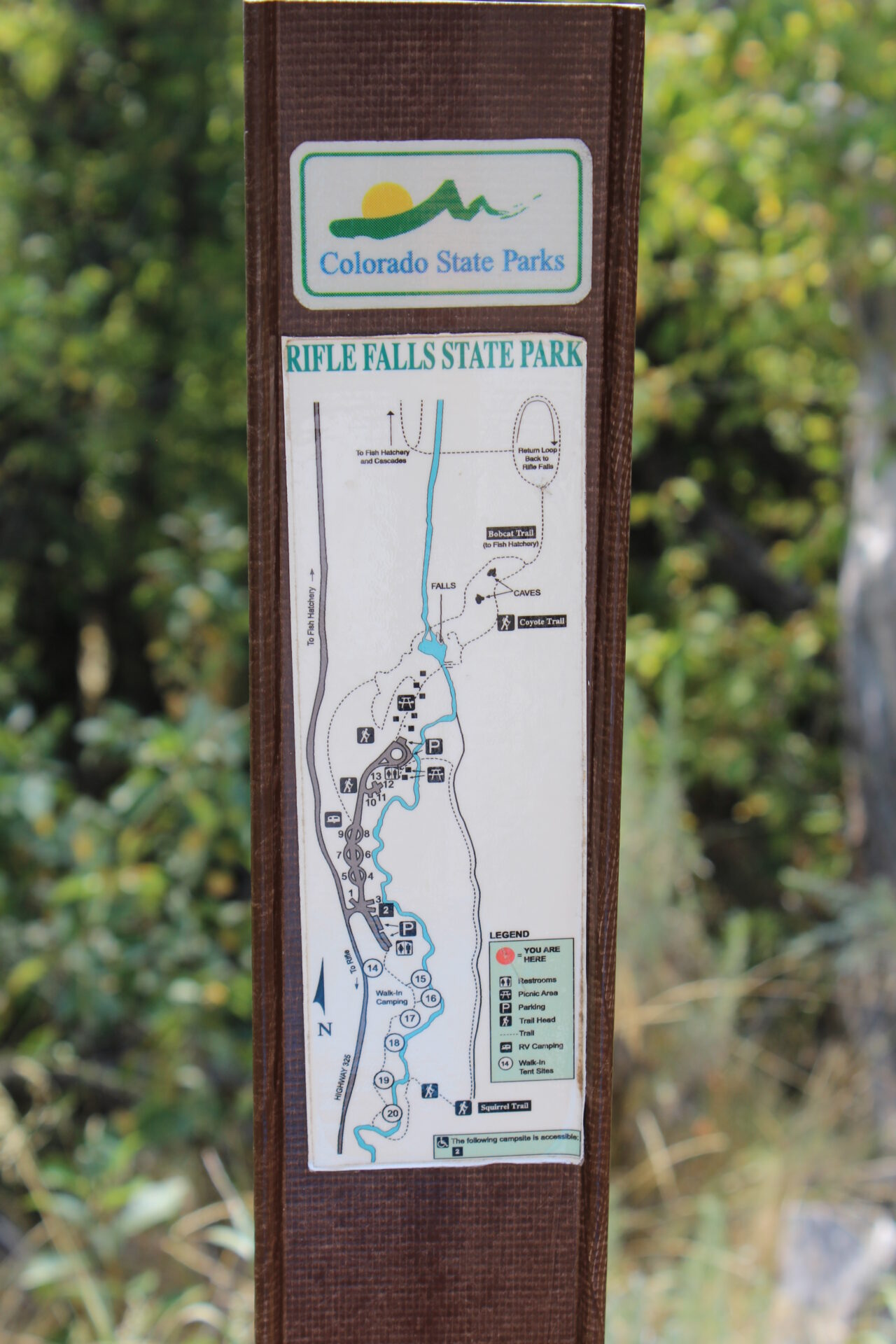
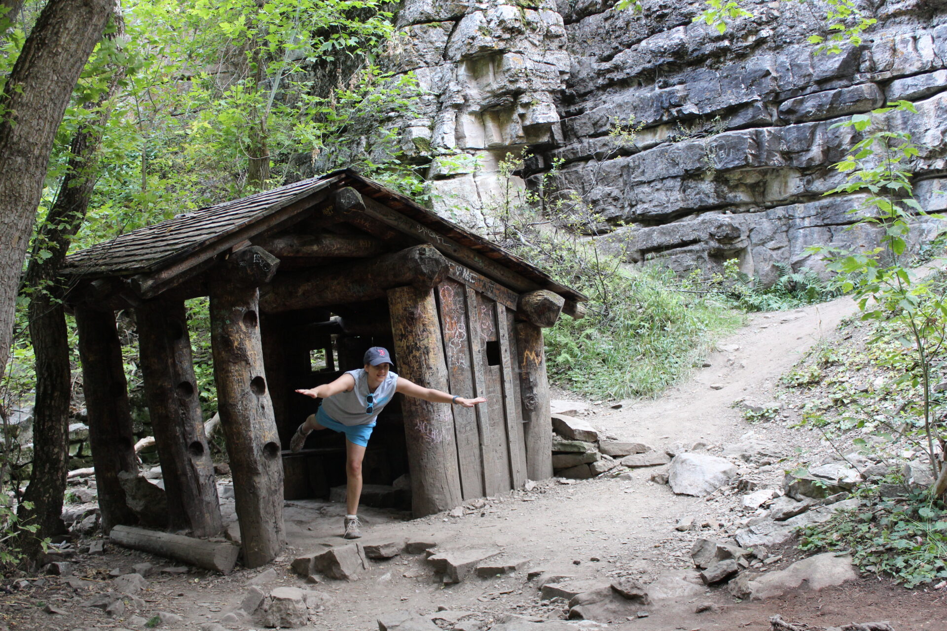
We kept the faith, despite questioning our direction finding based off our experience looking for Little Trappers the previous day. Eventually our patience was rewarded with an actual marker letting us know we were on the Bobcat trail, which we were finally able to locate on our map. We were very close to the falls at that point, and right at the caves.
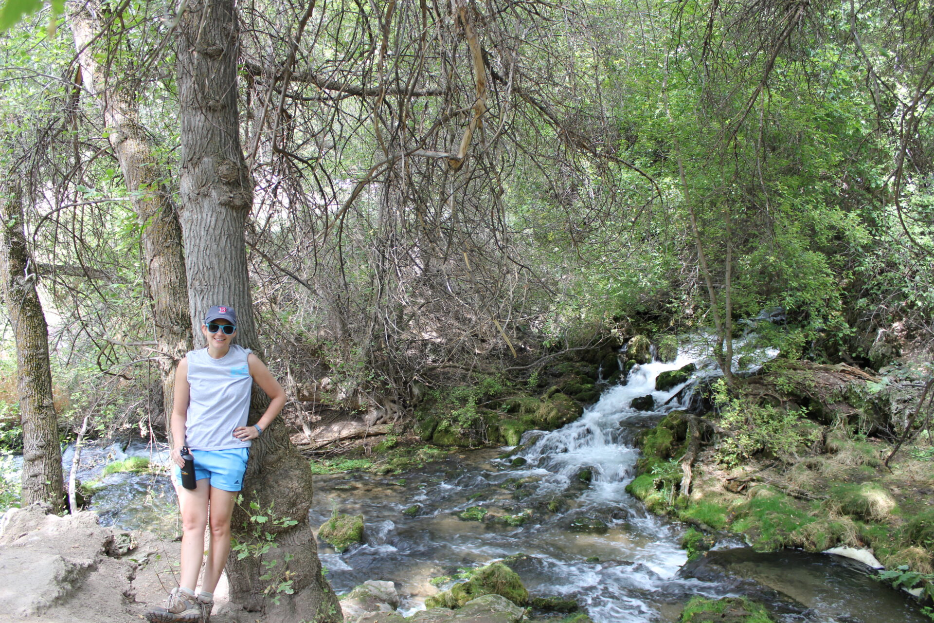
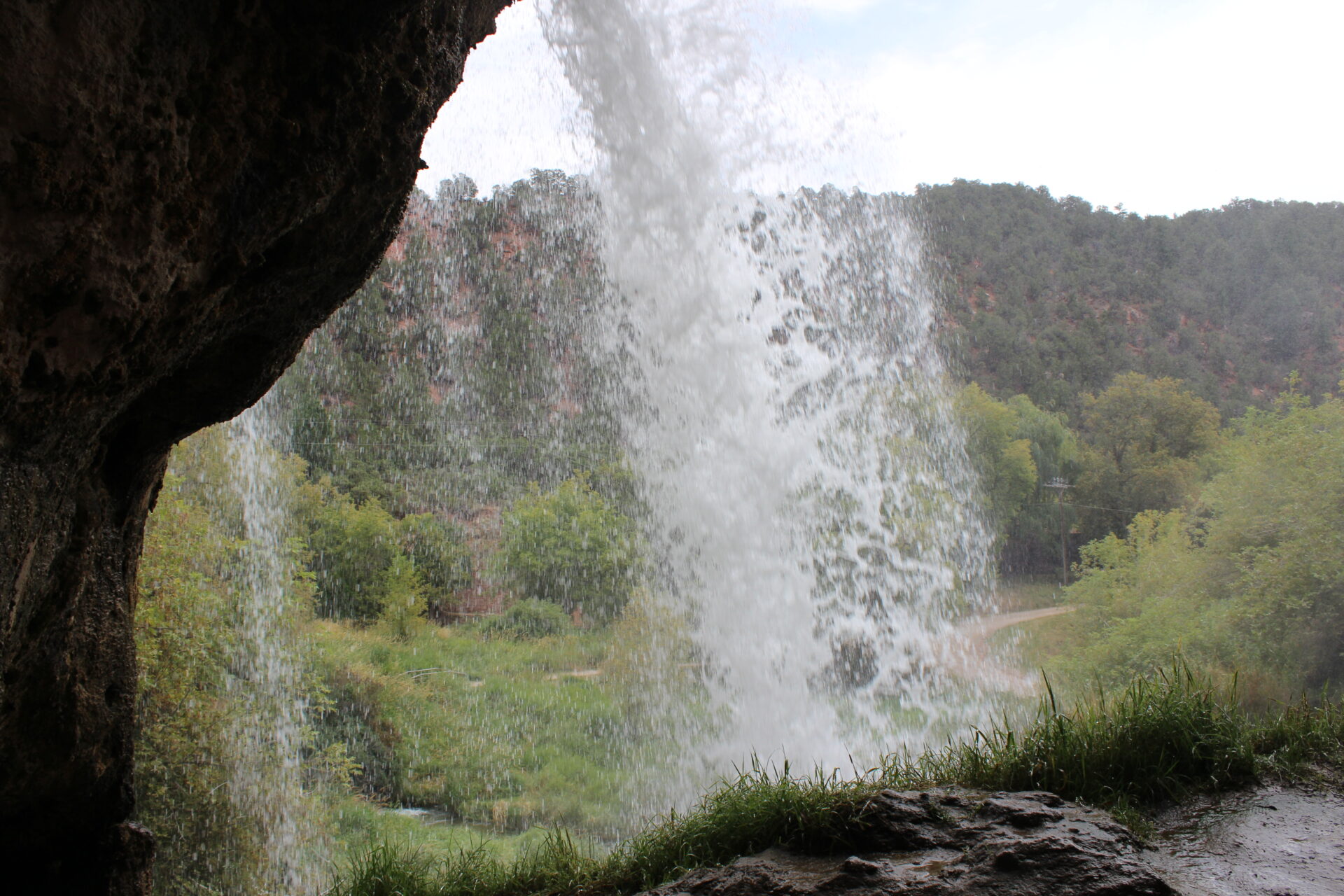
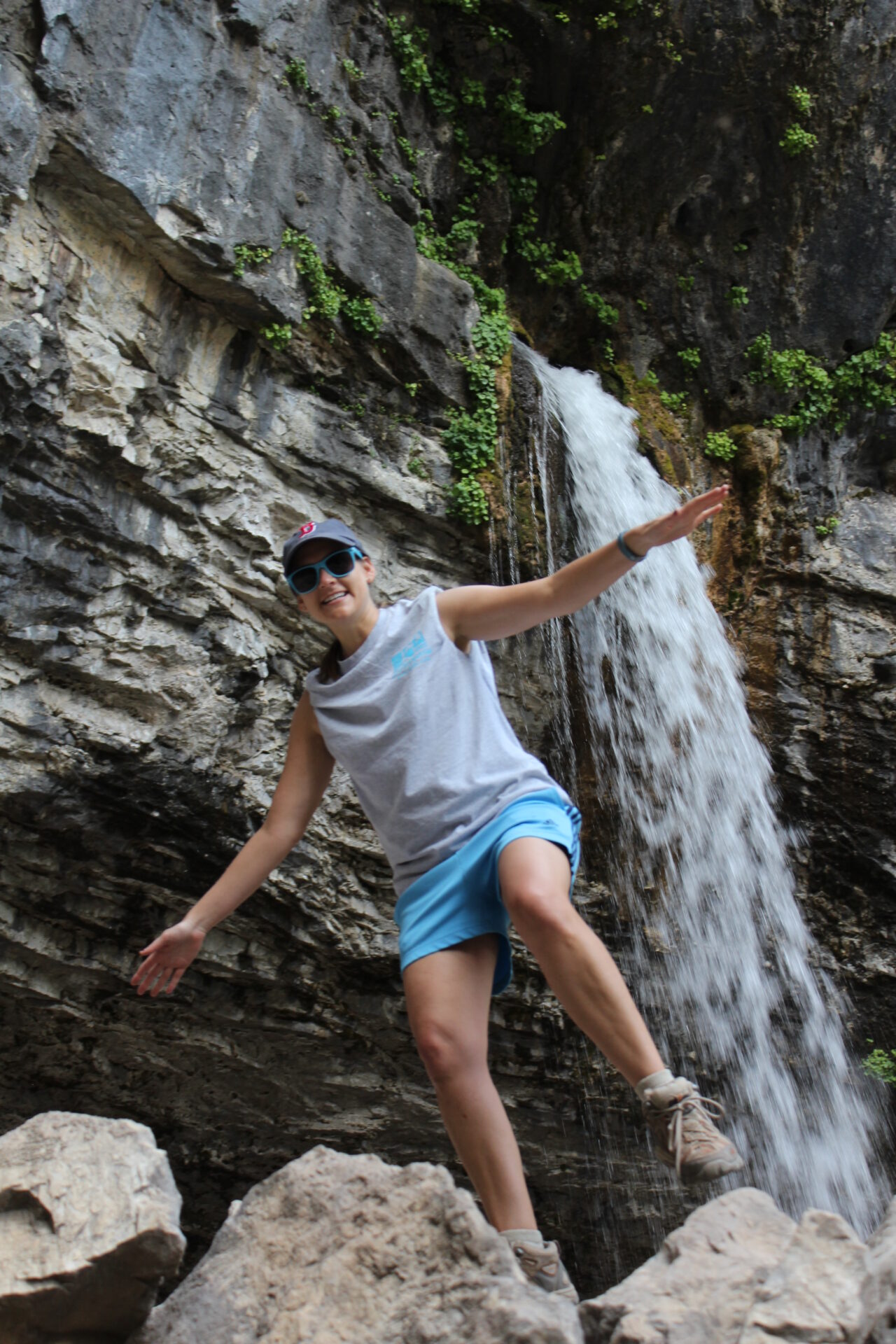
We did a little spelunking and then finally made it to the base of the Rifle Falls.


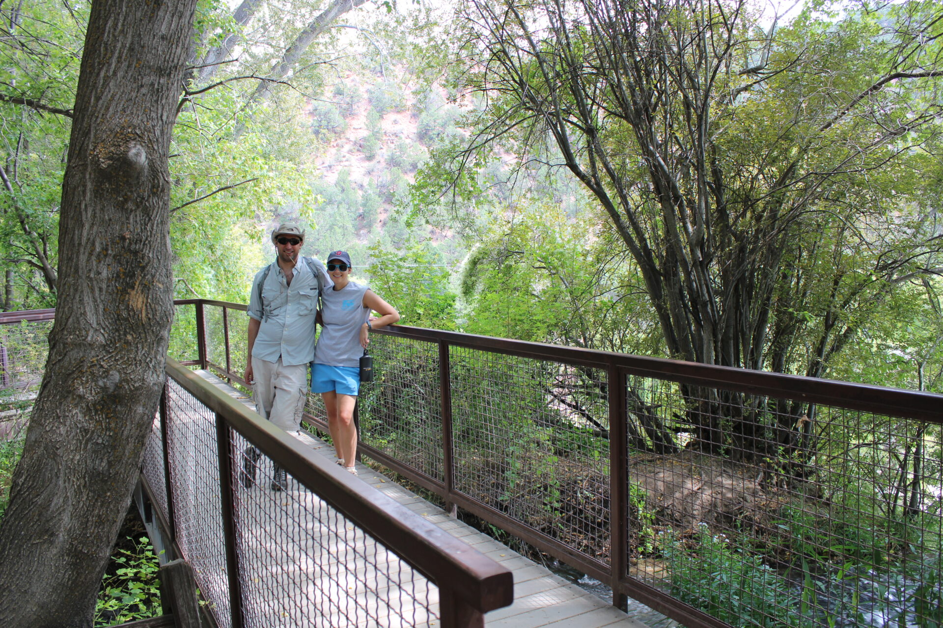
We talked to one of the Park workers about directions and he told us we could get to the top of the falls by taking the steps up on the left, or retracing our steps and taking the other fork at the Bobcat trail. We opted for the stairs, which we took after checking out behind the falls and getting some cool mist on our overheated selves.
After playing around at the top of Rifle Falls, we headed back on the other path towards the Bobcat trail, and then retraced our steps on the now left-most (near the road) route to the car.
We were on high alert for snakes because we saw about 3 on the hike down to Rifle Falls, hiding in the tall grass and slithering across our hiking path at our feet – but only spotted one on our return trip.
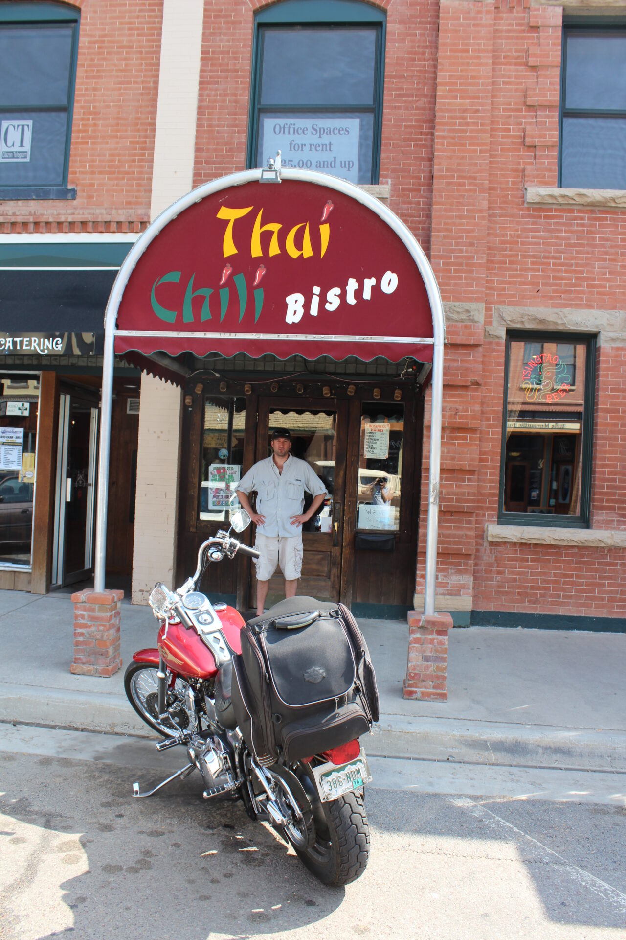
Back at the car, we planned our next move – Rifle, and lunch. After about 30 minutes, we reached the old town, parked and promptly asked a local where the best place to eat was. He said the Thai restaurant, so that’s what we did! It was pretty good considering, and a welcomed change of pace from Mexican in Meeker.
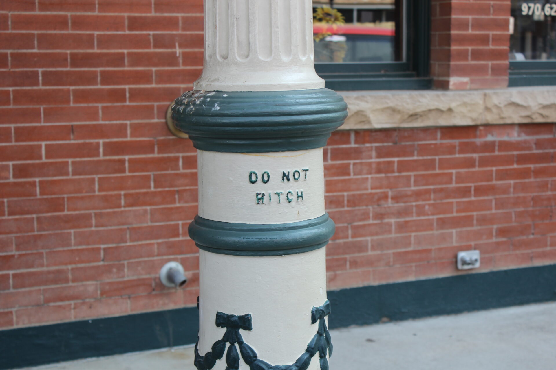
We also enjoyed the “no hitching” sign outside the restaurant, which was obviously a remnant of the days of horses as the primary means of transportation in the town.
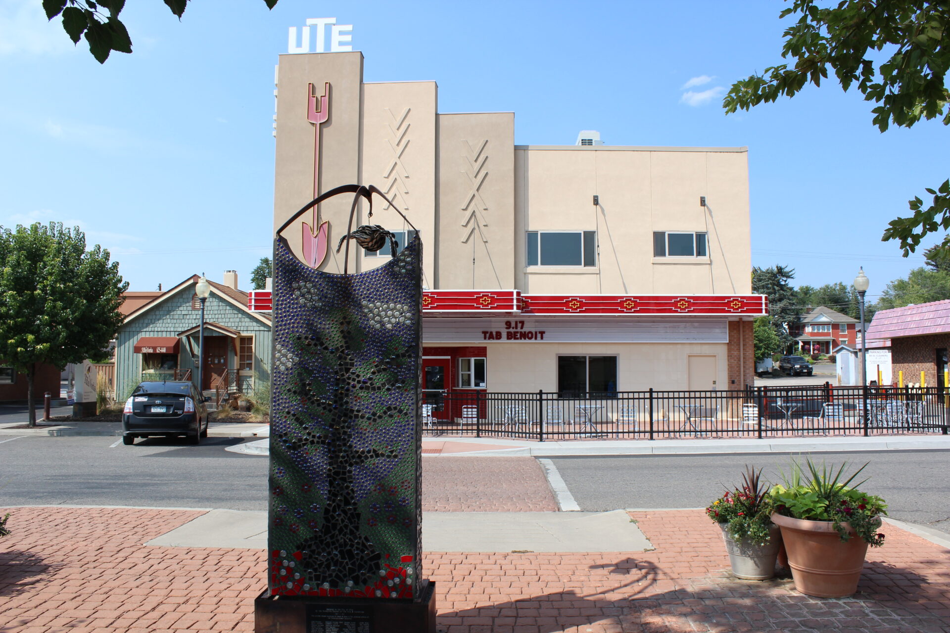
We tool a stroll after lunch and saw some cool art, and the local music venue.
We were on the road again towards Hanging Lake in Glenwood Springs around 3PM.
Just as we approached the Hanging Lake exit, we were temporarily discouraged by the sign that said the parking lot was full. We decided to ignore it and look anyways, and we’re glad we did – there were plenty of spaces that late in the day, and nobody had bothered to update the sign 🙁
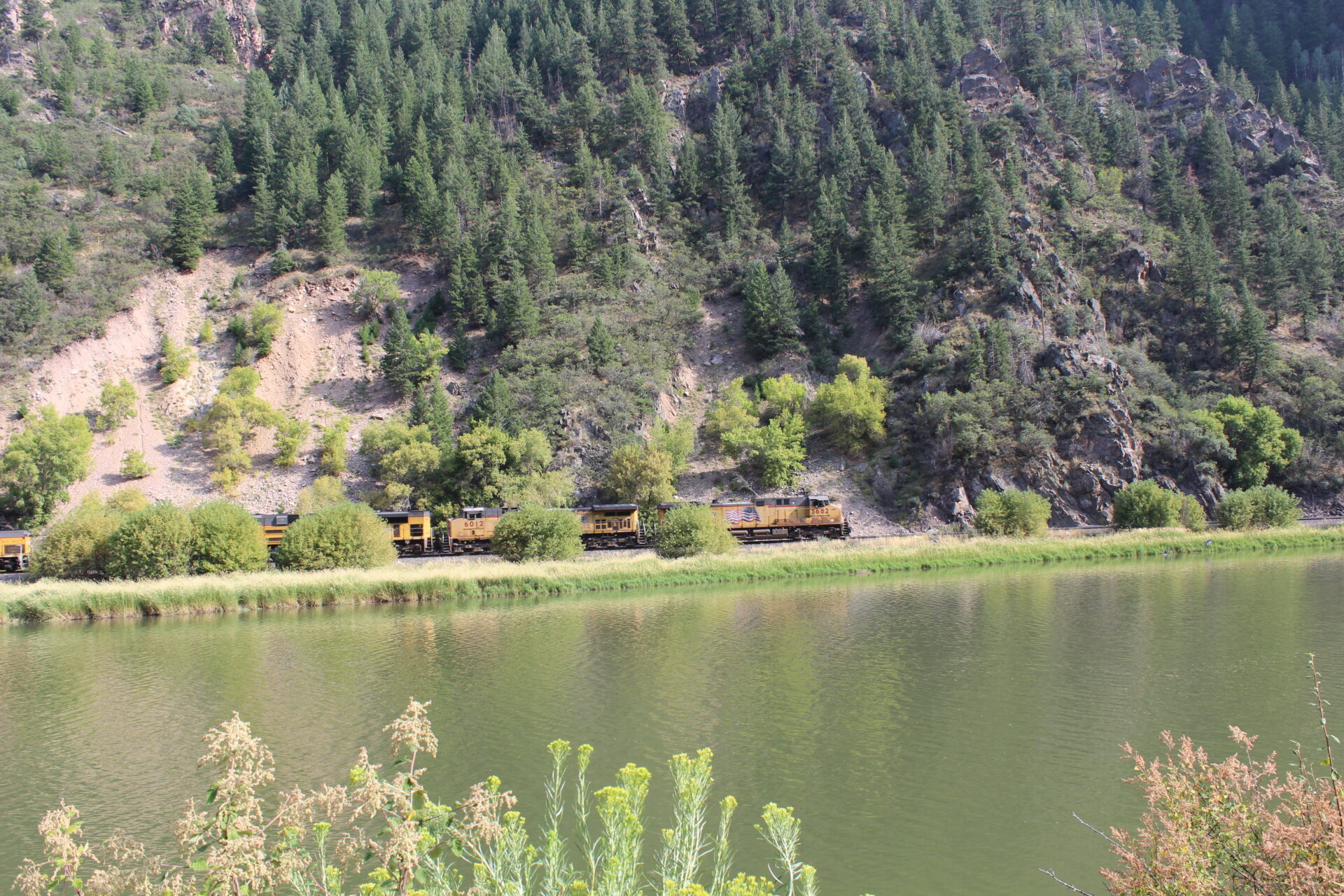
We asked a few very in-shape looking folks about the difficulty of the climb, and they said it was a steep incline uphill for about a mile and it should take 90 minutes to climb up. We prepared ourselves and ventured onto the trail, and a train passed us on the way.
We made it up in a record 40 minutes, and were well rewarded at the top.
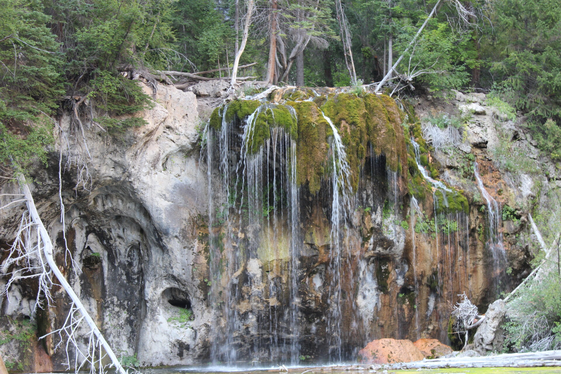
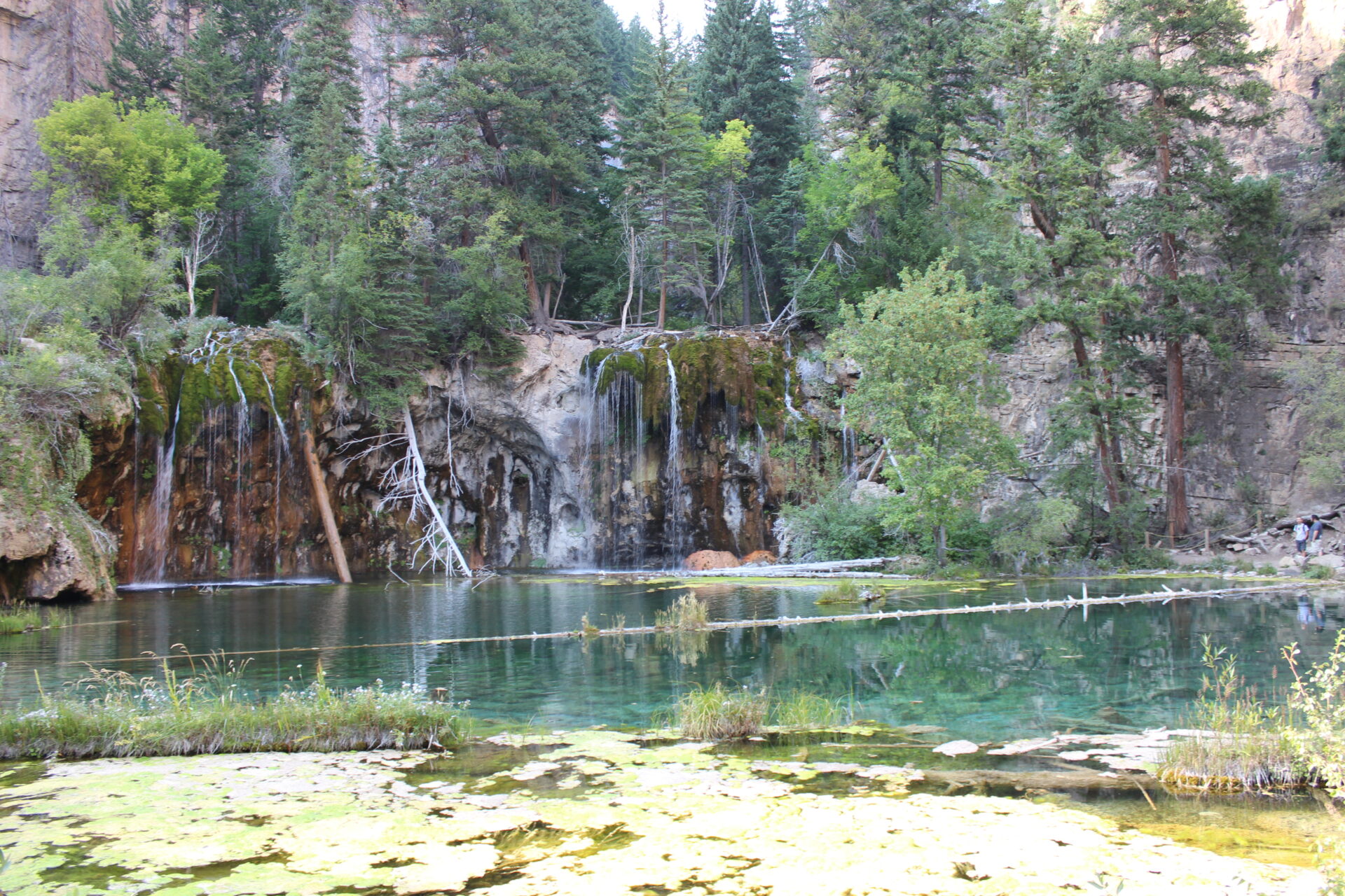
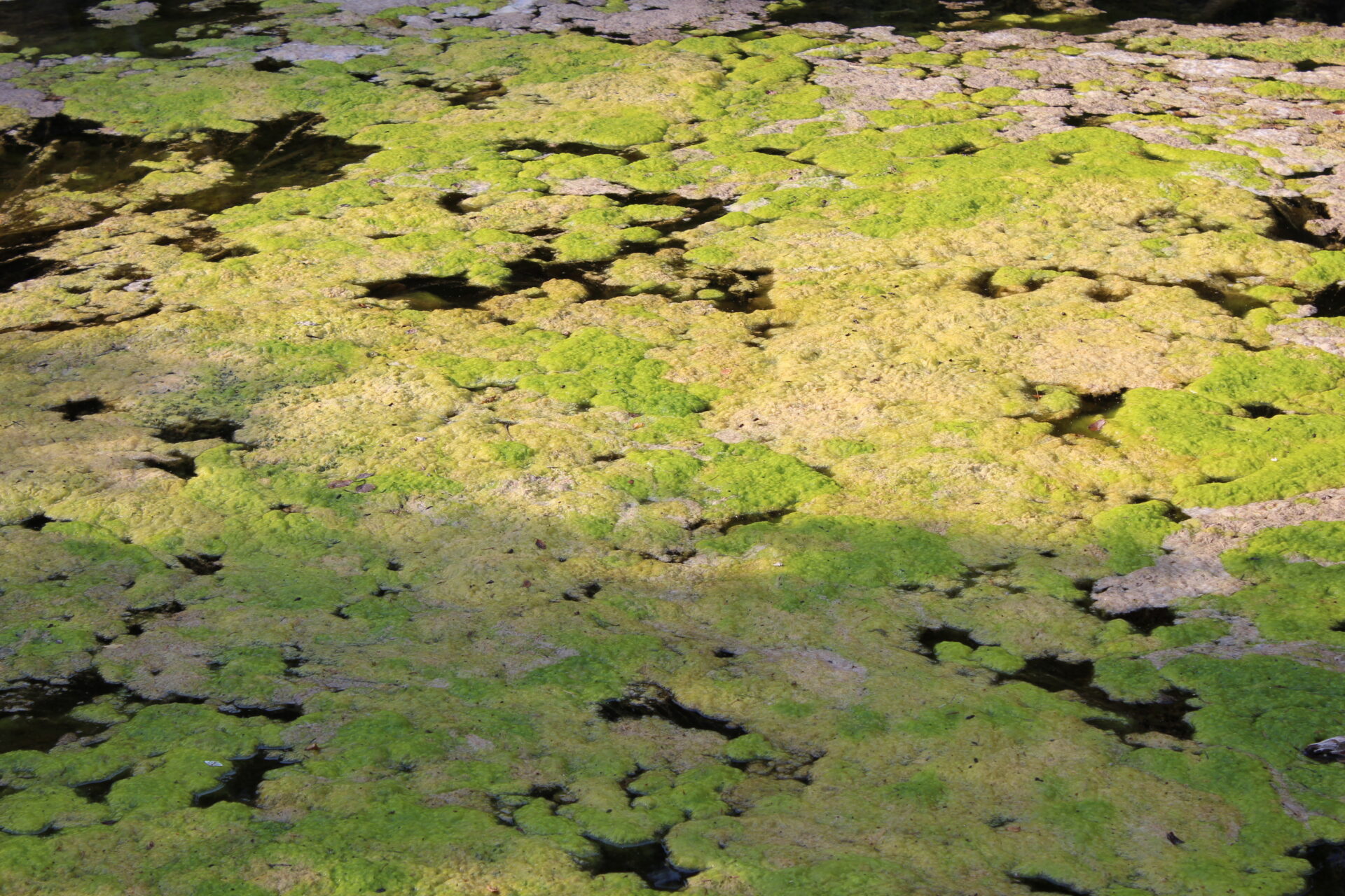
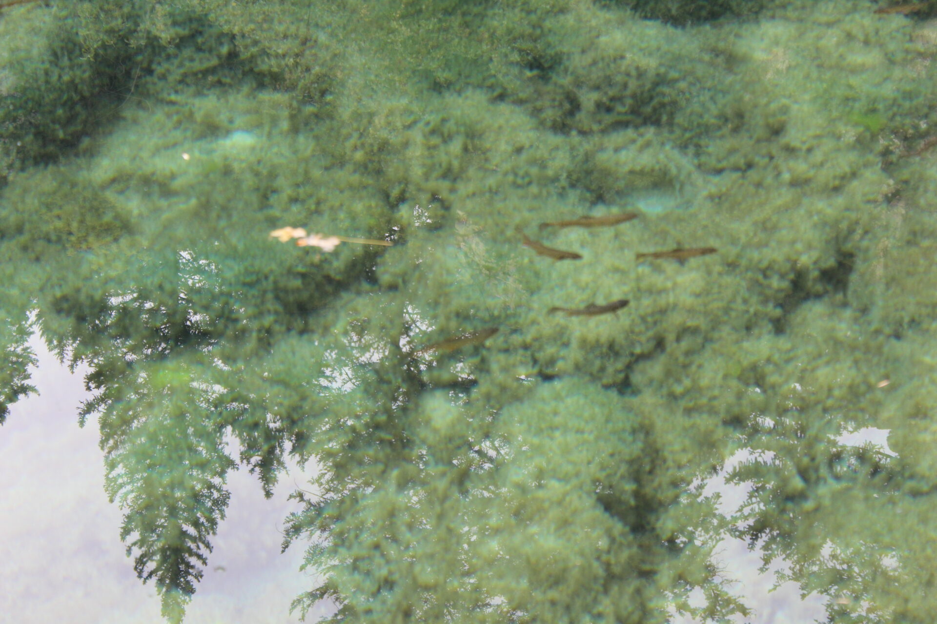
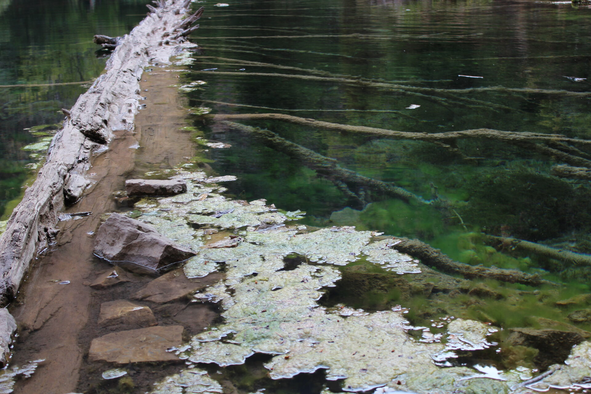
There were some really cool algae formations in the lake, and lots of fish!
Then we explored further up to the top of the Hanging Lake, where there was another waterfall. We were temporarily stymied at the top by a large group of Indians that had no courtesy for us trying to take pictures of the waterfall without them in it. This shot took 30 minutes to get right.
Back at the Hanging Lake area, we got this great shot of the mountains with the sun casting some neat colors on them.
Going down was way faster and we probably reached the bottom in 30 minutes, after having a little fun on the way.
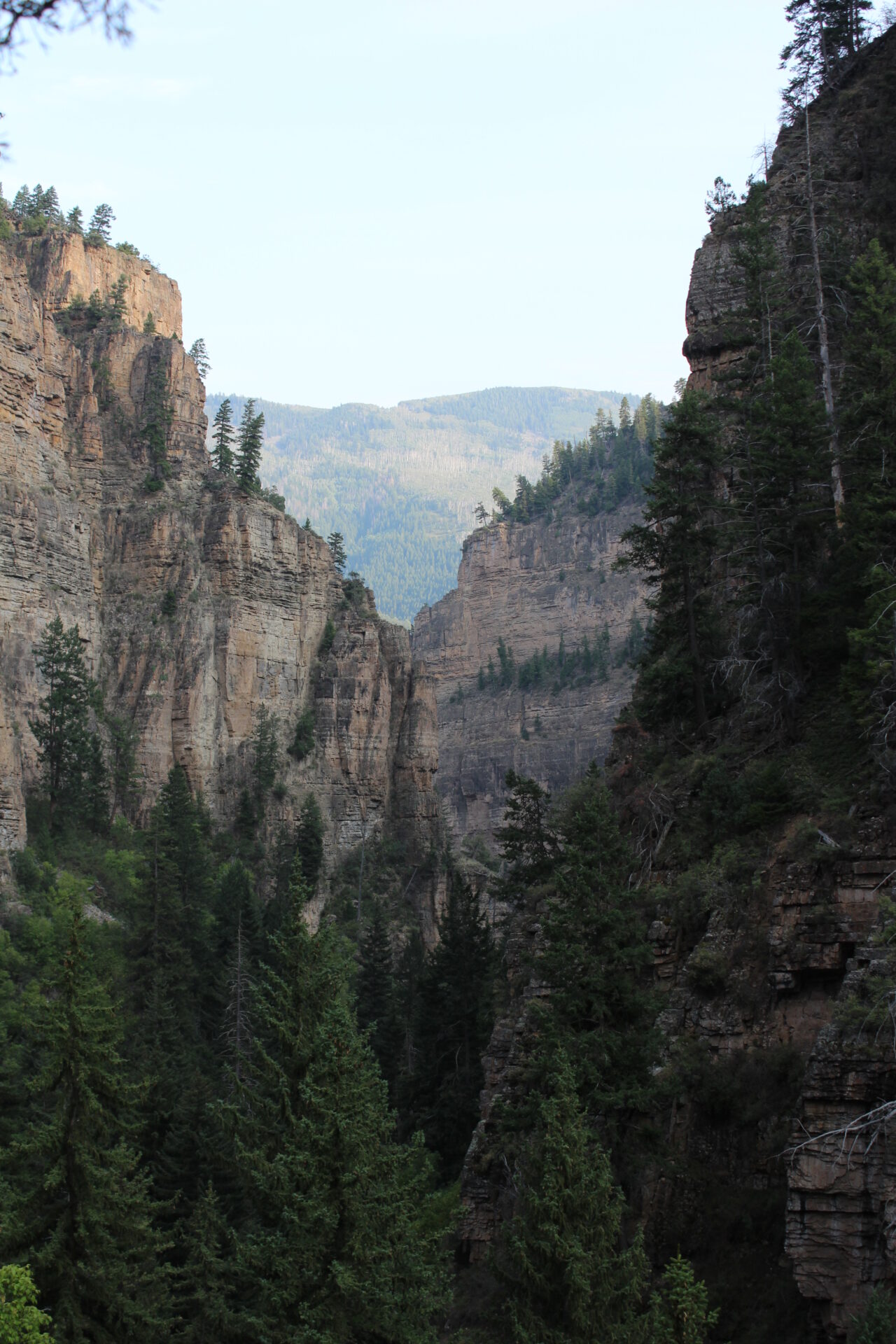
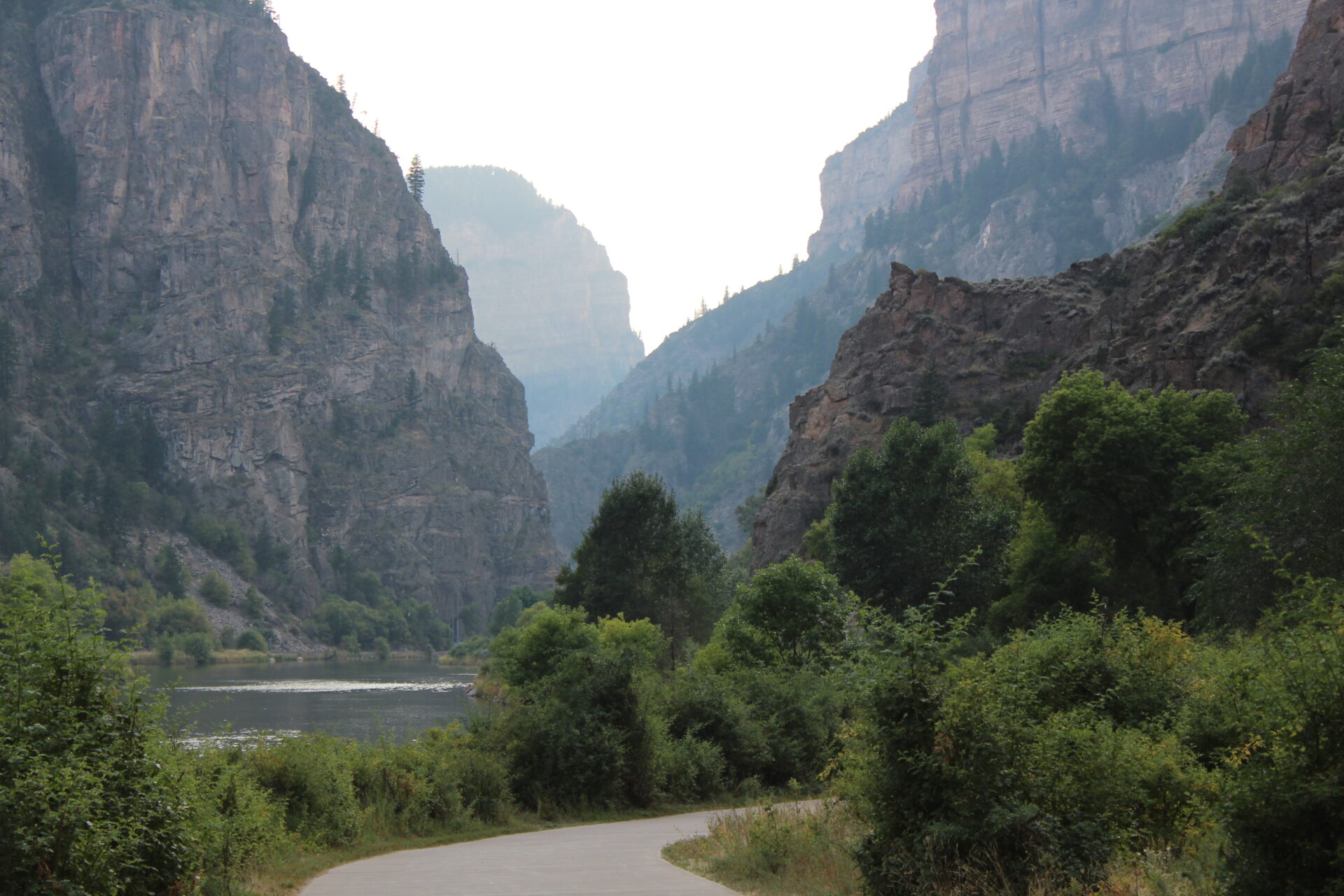
At the bottom, we hopped in the car, and started on our journey home. Here were our last views of the park.
The drive was pleasant and our timing was perfect – completely avoiding all traffic on I70, which for a Sunday is saying a lot. We passed through Vail and Breckenridge again just at dusk and it was just beautiful.
The only negative portion of the drive was a big accident that just happened, throwing the driver from the car. When we passed, cars were slamming on their brakes, nearly causing secondary pile-ups. One of the people in the accident was on the side of the road, presumably dead – or at least in horrible shape. Lots of blood. We called 911 just in case, but luckily others before us had as well. We saw ambulances coming the other way on I70 West on our way out. This was sobering.
We reached back to Denver downtown around 9PM, I dropped Dave off and was home by 915PM.
It was a perfect trip.